Tag Archives: far north queensland

Tropical Cyclone Yasi track map

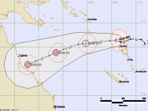
The Fijian Met Service has released a predictive track map for Tropical Cyclone Yasi. It could reach here on 2nd February. Not looking good for the north of Queensland:

Tropical Cyclone Yasi

Tropical Cyclone Yasi

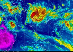
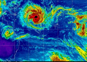
Here is the link for the NOAA MTSAT IR Colourised Loop for the southern hemisphere again. And a still for the Flash-impaired:

NOAA MTSAT IR Colourised Loop

NOAA MTSAT IR Colourised Loop

Time to nail a few things down, probably.

Please note: These maps are only here as a living record of passing cyclones from the viewpoint of an ordinary FNQer. The info presented is out of date as soon as it is posted. If you want the latest information you should always check the BoM Cyclone page.

Cyclone Anthony vs Cyclone Yasi

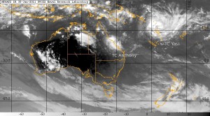
I alluded earlier to Tropical Cyclone Yasi being a bit larger than Tropical Cyclone Anthony. This image from the US Navy will give you some perspective. As always, click to see the full-sized version:

US Navy - Cyclone Anthony vs Cyclone Yasi

US Navy - Cyclone Anthony vs Cyclone Yasi

Image copyright US Navy/public domain. Cyclone names added by me.

Please note: These maps are only here as a living record of passing cyclones from the viewpoint of an ordinary FNQer. The info presented is out of date as soon as it is posted. If you want the latest information you should always check the BoM Cyclone page.

Tropical Cyclone Yasi

Tropical Cyclone Anthony is a bit of a worry for those directly in its path but if the predictions are correct it won’t be much worse than TC Tasha was on Christmas day.  Tropical Cyclone Yasi is sitting behind Anthony, currently heading this way and is a bit bigger than TC Anthony.

Here is the NOAA MTSAT IR Colourised Loop for the southern hemisphere.

This is a still from the animated colourised loop if you happen to be browsing on a device that doesn’t support Flash (iPhone, iPad, etc)
NOAA MTSAT Infrared Colourised Image Loop

NOAA MTSAT Infrared Colourised Image Loop

And this is the US Navy’s predicted track map for Cyclone Yasi:
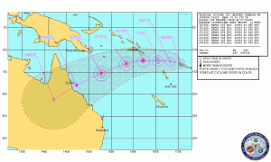
Tropical Cyclone Yasi Track Map

Tropical Cyclone Yasi Track Map

I’m hoping they have this wrong.

Edit: From the BoM three day outlook issued at 1547:

Potential Cyclones:
No other significant lows are expected to develop or move into the region on Monday, however Tropical Cyclone Yasi is currently located near Vanuatu and forecast to move west into the Coral Sea on Tuesday. Likelihood of a new tropical cyclone occurring in the Eastern Region on:

Monday: Low
Tuesday: High
Wednesday:High

NOTE: The likelihood is an estimate of the chance of each system being a tropical cyclone in the Region for each day.
Very low: less than 5% Low: 5% – 20%
Moderate: 20% – 50% High: Over 50%

Please note: These maps are only here as a living record of passing cyclones from the viewpoint of an ordinary FNQer. The info presented is out of date as soon as it is posted. If you want the latest information you should always check the BoM Cyclone page.
Latest Tropical Cyclone Anthony track maps

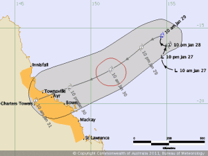
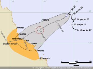
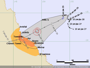
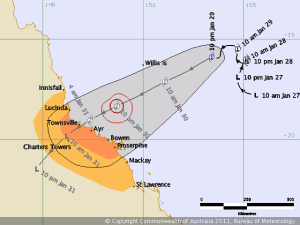
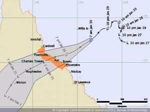
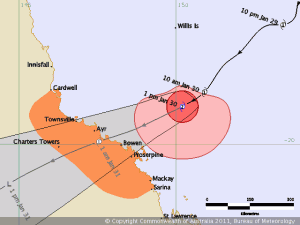
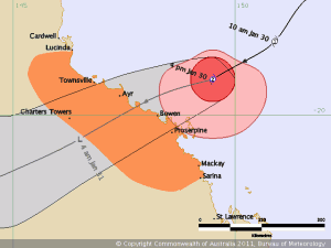
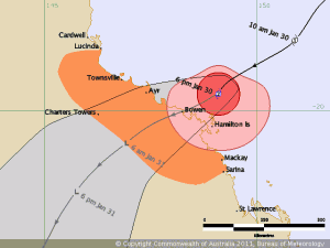
The good people at BoM are doing a great job with the track predictions:

Tropical Cyclone Anthony

Tropical Cyclone Anthony

Tropical Cyclone Anthony

Tropical Cyclone Anthony

Tropical Cyclone Anthony

Tropical Cyclone Anthony

Tropical Cyclone Anthony

Tropical Cyclone Anthony

Tropical Cyclone Anthony

Tropical Cyclone Anthony

Tropical Cyclone Anthony

Tropical Cyclone Anthony

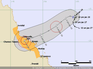
The coast-crossing point is a little further south than first thought but current predictions are also showing that it may well only be Cat 1 when it crosses.

Edit 1: This is the 1644 track map. Heading further south again:

Tropical Cyclone Anthony

Tropical Cyclone Anthony

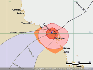
Edit 2: The 1900 track map shows another shift further south and directly across Bowen:

Tropical Cyclone Anthony

Tropical Cyclone Anthony

Edit 3: The 2200 track map has been released and you can see how close the centre of the eye is to the coast at Bowen:

Tropical Cyclone Anthony

Tropical Cyclone Anthony

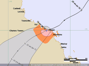
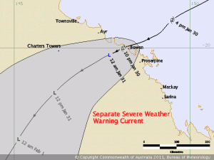
Edit 4: 2300 – Cyclone Anthony has crossed the coast at Bowen and is now Category 1 again:

Tropical Cyclone Anthony

Tropical Cyclone Anthony

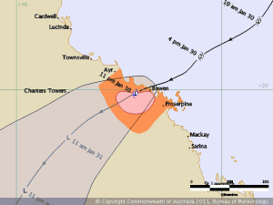
Edit 5: 0008 track map. The centre is well inland now and should be a low within twelve hours:

Tropical Cyclone Anthony

Tropical Cyclone Anthony

Edit 6: That’s it, TC Anthony is an ex-cyclone and now classed as a tropical low. It would be good if it fizzled out sooner rather than later as south of here doesn’t need any more rain:

Tropical Cyclone Anthony

Tropical Cyclone Anthony

Many thanks to BoM for the track map images.

Please note: These maps are only here as a living record of passing cyclones from the viewpoint of an ordinary FNQer. The info presented is out of date as soon as it is posted. If you want the latest information you should always check the BoM Cyclone page.