The Fijian Met Service has released a predictive track map for Tropical Cyclone Yasi. It could reach here on 2nd February. Not looking good for the north of Queensland:
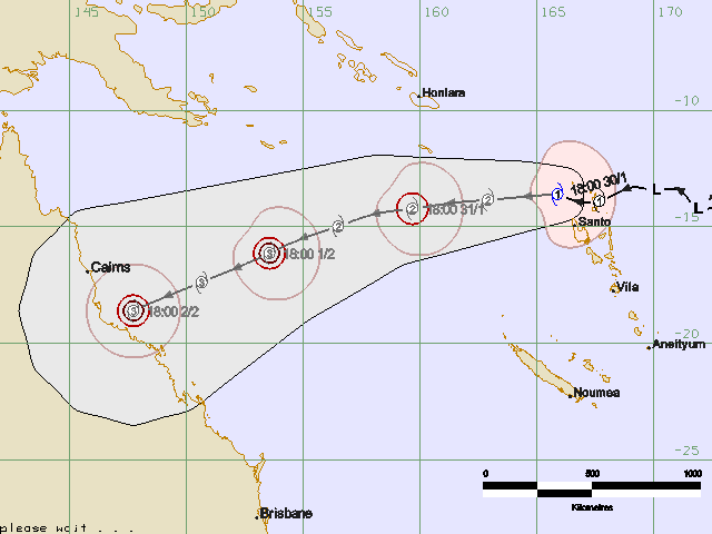
Tropical Cyclone Yasi
Here is the link for the NOAA MTSAT IR Colourised Loop for the southern hemisphere again. And a still for the Flash-impaired:
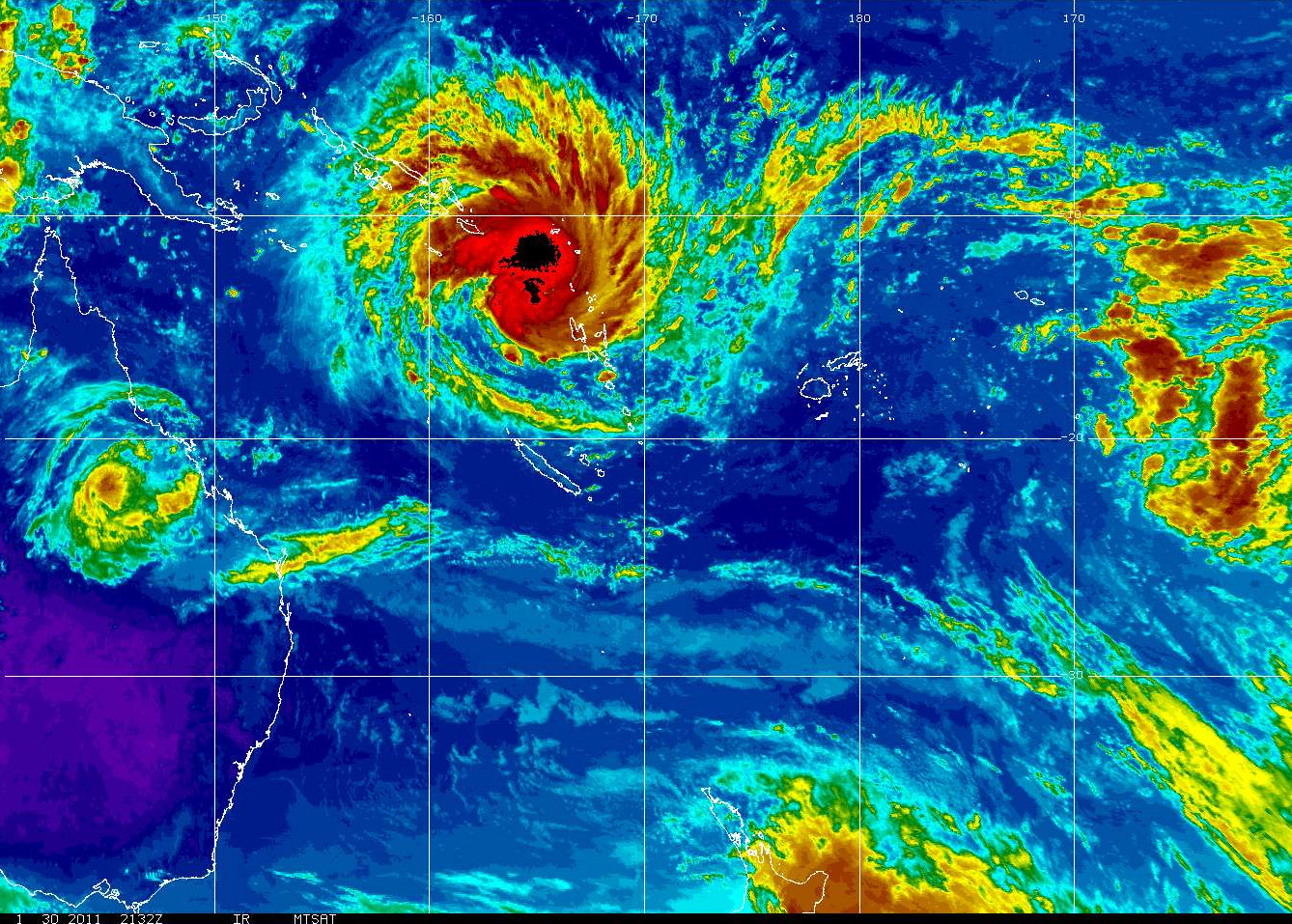
NOAA MTSAT IR Colourised Loop
Time to nail a few things down, probably.
Please note: These maps are only here as a living record of passing cyclones from the viewpoint of an ordinary FNQer. The info presented is out of date as soon as it is posted. If you want the latest information you should always check the BoM Cyclone page.
fun