The first BoM track/threat map has been issued by BoM despite it not quite being in our area yet. A Cyclone Watch has been declared for coastal and island communities from Cooktown to Yeppoon. I’ll try and keep this post updated as new information becomes available.
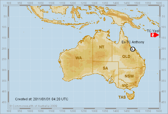
This first image should give you an idea of where it is relative to Australia as a whole:
Tropical Cyclone Yasi
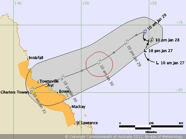
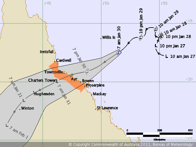
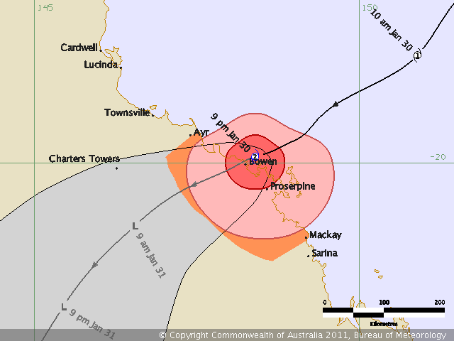
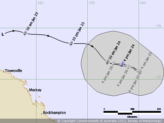
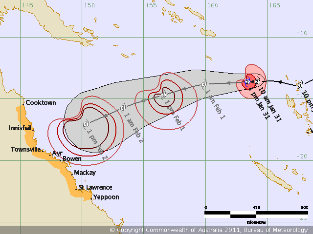
And here’s the first track map posted at 1349:
Tropical Cyclone Yasi
It’s the “big, ugly sister” of Cyclone Anthony, according to QLD Police. Quite an apposite description, I’d say.
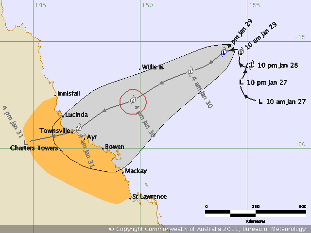
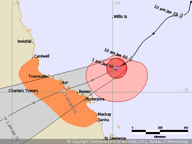
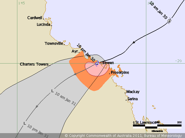
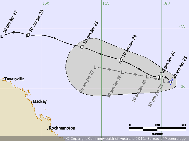
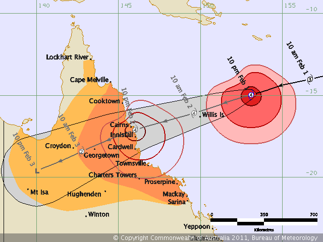
Edit 1: 2011-01-31 1700 BoM update:

Tropical Cyclone Yasi
Edit 2: 2011-01-31 1735 NOAA MSAT IR image. This baby is big:
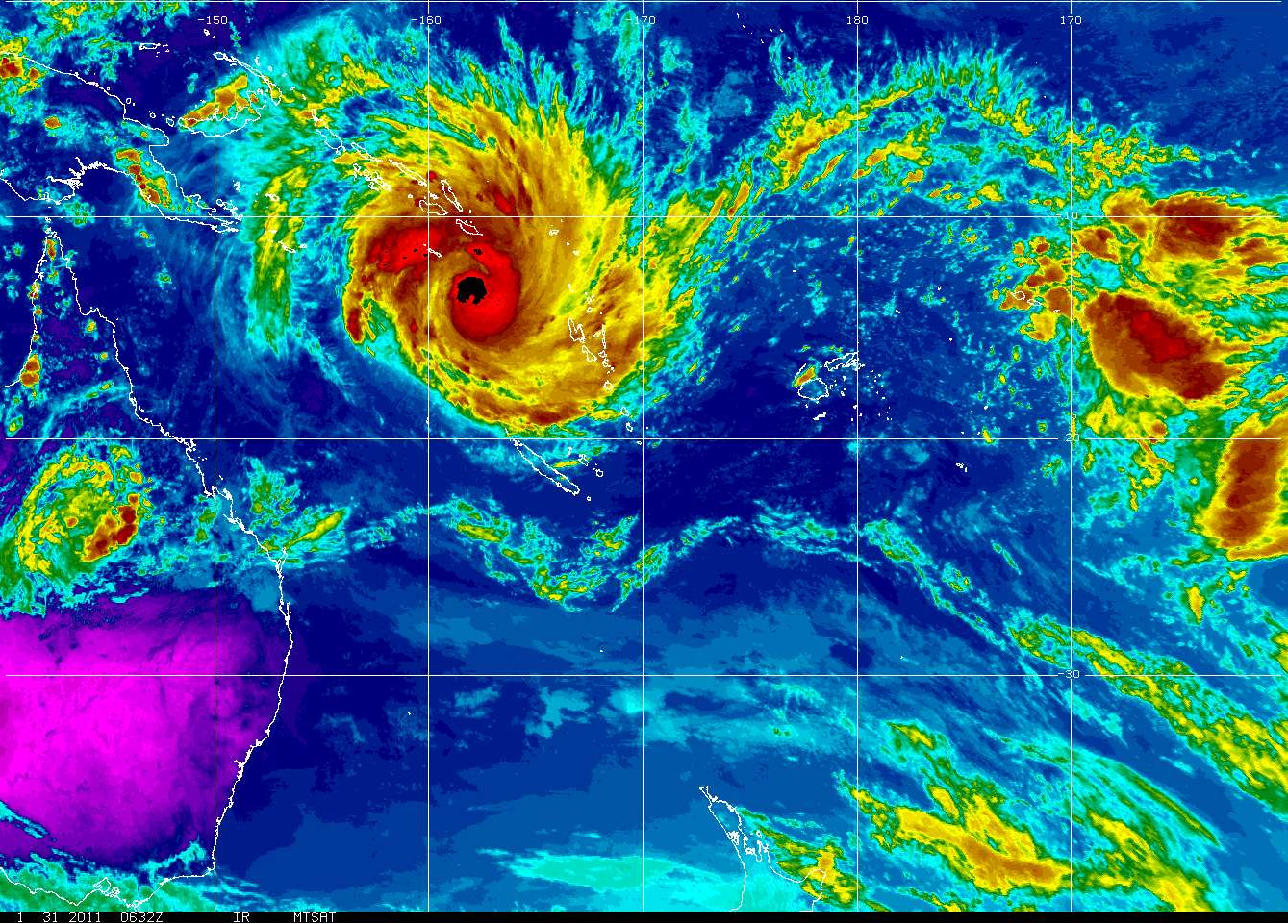
NOAA MTSAT IR Colourised Loop
Edit 3: 2011-01-31 2020. Via the UK Met Office, an image from CIMSS at the University of Wisconsin:
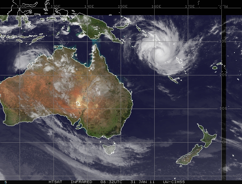
CIMSS Satellite Image
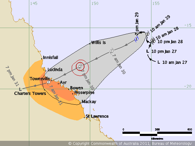
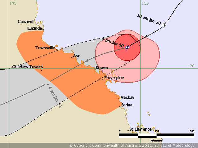
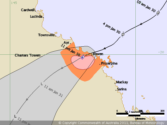
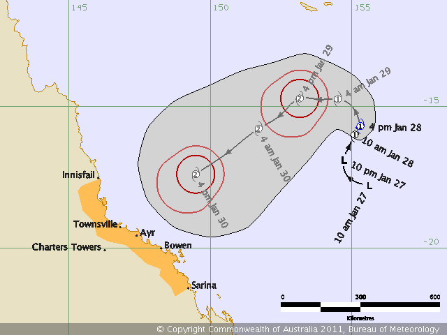
Edit 4: 2011-01-31 2305 Updated track map from BoM. The predictive track is now a little further north. Right over us:

Tropical Cyclone Yasi
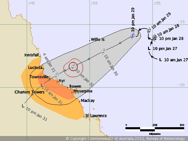
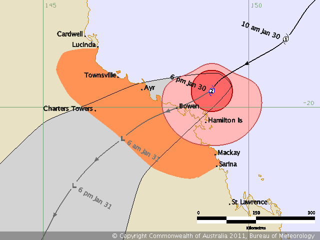
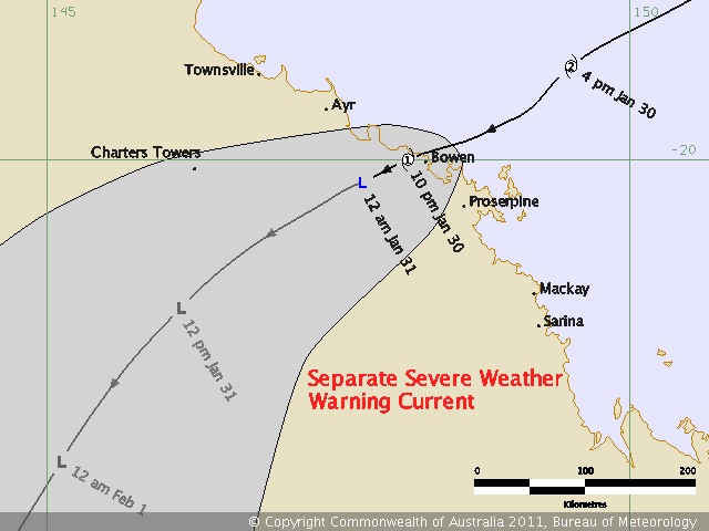
Edit 5: 2011-02-01 0722 Latest track map. It looks like the possible coast crossing point is now further north and closer to Cairns:

Tropical Cyclone Yasi
NASA has a new article about Yasi with a good satellite image.
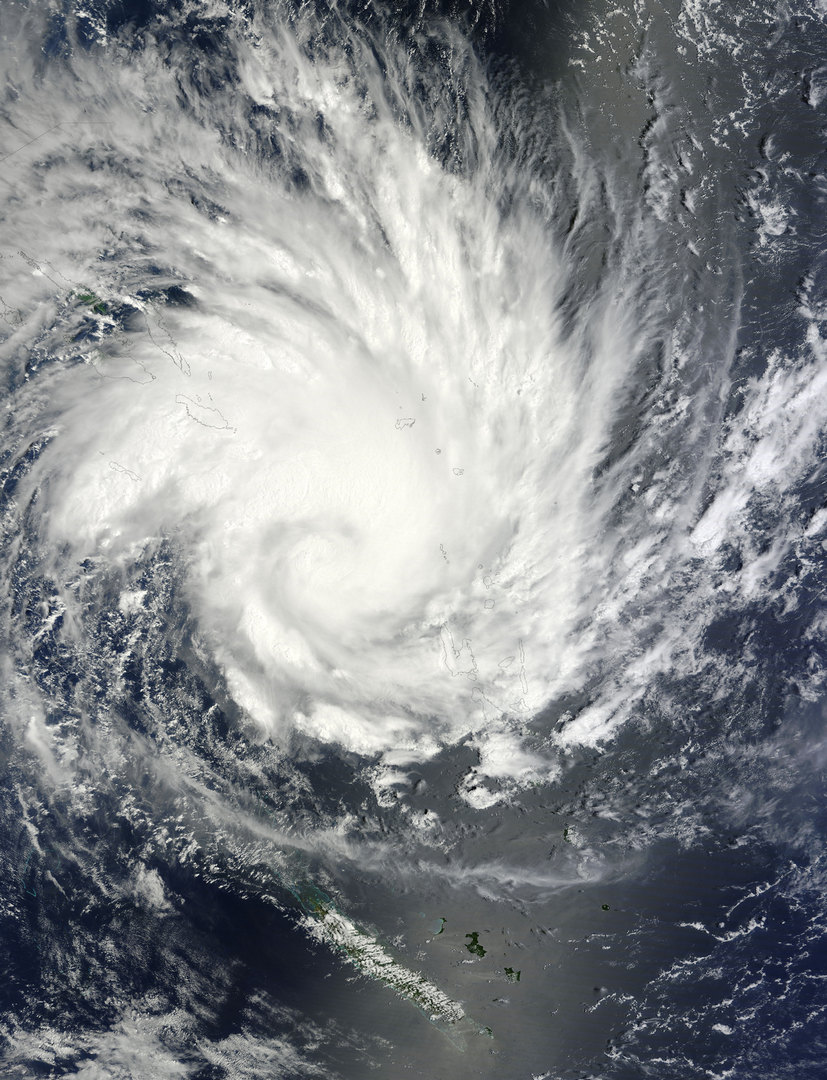
NASA Satellite image of Tropical Cyclone Yasi
Edit 6: 2011-02-01 1116 BoM Advice No.5 and track map are out. Predicted track just north of Cairns now:
Tropical Cyclone Yasi
Excellent satellite and radar timelapse vid of Cyclone Yasi.
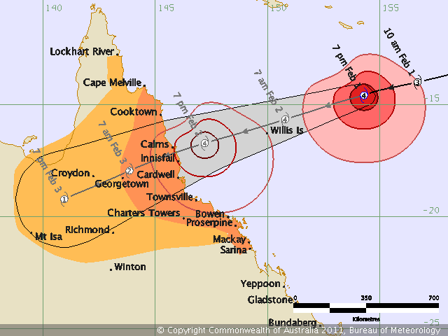
Edit 7: 2011-02-01 1405 Latest BoM Advice and track map. Looks centred on Cairns now:
Tropical Cyclone Yasi
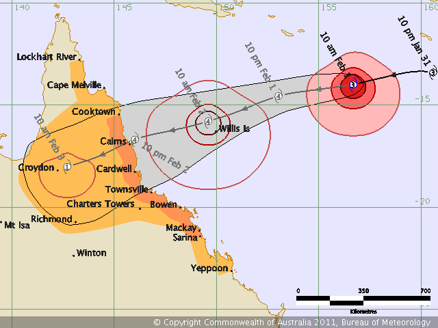
Edit 8: 2011-02-01 1705 The 5pm BoM advice and track map is out. Looks like it’s heading further south again. At this rate it’ll cross right over our heads:
Tropical Cyclone Yasi
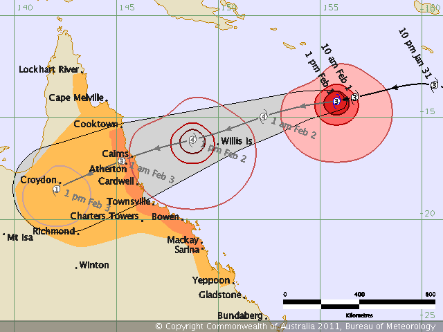
Edit 9: 2011-02-01 2004 Latest BoM advice and track map (No.8). Direction seems to have stabilised but it is now a Cat 4:
Tropical Cyclone Yasi
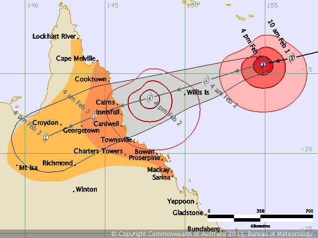
Edit 10: 2011-02-01 2304 Track map and advice No.9 from BoM. The predicted track seems to have settled but that easily change in the next 23 hours:
Tropical Cyclone Yasi
Please note: These maps are only here as a living record of passing cyclones from the viewpoint of an ordinary FNQer. The info presented is out of date as soon as it is posted. If you want the latest information you should always check the BoM Cyclone page.